Brunt of Matthew Likely to Miss Jamaica, Tropical Storm Conditions Still to Be Expected

Hurricane Matthew has proven to be a very unpredictable storm.
Over the past few days, the massive storm surprised meteorologists with a period of extremely rapid intensification, which saw the system strengthen from a tropical storm to a Category 5 in just 36 hours.
Computer generated projections in recent days have also been varied.
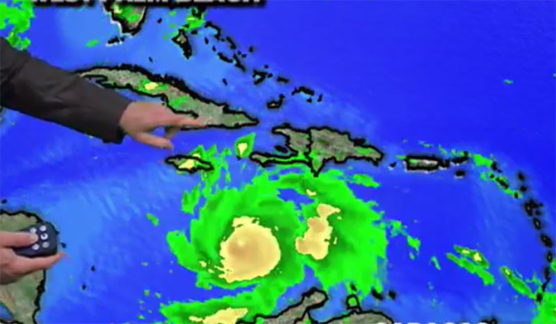
Initial projections showed Jamaica directly in the cross-hair of the storm but the most recent projections now show Matthew passing close to the island with Haiti being expected to be impacted heavily.
The most destructive section of storms in the northern hemisphere is usually in the eyewall area to the right of the eye.
It is important to note that even if the most powerful section of the hurricane does not pass directly over Jamaica, there is still great potential for widespread flooding and landslides as tropical storm force winds extend as far as 200 miles from the storm’s centre.
As of 5 am, Monday (October 3), Matthew remains a Category 4 hurricane with winds of 130 mph, and a speed of 6 mph.
The storm remains south of Jamaica and is expected to retain its Category 4 status over the coming days as it continues to move north.
Download The Jamaican Blogs™ App for your Android device: HERE
Remember to share this article on Facebook and other Social Media Platforms. To submit your own articles or to advertise with us please send us an EMAIL at: [email protected]